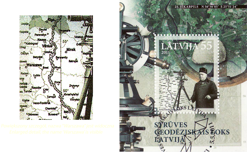
| Date | 2011, 05 V |
|---|---|
| Value | 55 (=0,55 LVL) |
| Catalog no. | Mi 807 Sc 781b SG -- Y&T -- |
| Topic | Warsaw . |
| Occasion | Struve Geodetic Arc |
| Description | The Struve Geodetic Arc is a chain of survey triangulations stretching from Hammerfest in Norway to the Black Sea, over 2,820 km, which yielded the first accurate measurement of a meridian.The chain was established and used by the German-born Russian scientist Friedrich Georg Wilhelm von Struve in the years 1816 to 1855 to establish the exact size and shape of the earth. The Struve Arc passes Poland through Belarus. On the map some Polish cities are visible, especially Warsaw. |